
Topografische Karte Erskine
Interaktive Karte
Klicken Sie auf die Karte, um die Höhe anzuzeigen.
Über diese Karte
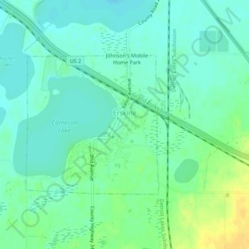
Name: Topografische Karte Erskine, Höhe, Relief.
Ort: Erskine, Polk County, Minnesota, United States (47.65813 -96.02588 47.67320 -96.00349)
Durchschnittliche Höhe: 365 m
Minimale Höhe: 357 m
Maximale Höhe: 381 m
Andere topografische Karten
Klicken Sie auf eine Karte, um ihre Topografie, ihre Höhe und ihr Relief anzuzeigen.
Lengby
United States > Minnesota > Polk County > Lengby
Lengby, Polk County, Minnesota, United States
Durchschnittliche Höhe: 423 m
Fosston
United States > Minnesota > Polk County
Fosston, Polk County, Minnesota, 56542, United States
Durchschnittliche Höhe: 393 m
Crookston
United States > Minnesota > Polk County
Crookston, Polk County, Minnesota, 56716, United States
Durchschnittliche Höhe: 269 m