
Topografische Karte A`zaz
Interaktive Karte
Klicken Sie auf die Karte, um die Höhe anzuzeigen.
Über diese Karte
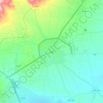
Name: Topografische Karte A`zaz, Höhe, Relief.
Ort: A`zaz, Azaz District, Aleppo, Syria (36.54644 37.00643 36.62644 37.08643)
Durchschnittliche Höhe: 559 m
Minimale Höhe: 499 m
Maximale Höhe: 751 m
During the Crusader era, Azaz, which was referred to in Crusader sources as "Hazart", became of particular strategic significance due to its topography and location, overlooking the surrounding region. In the hands of the Muslims, Azaz stymied communications between the Crusader states of Edessa and Antioch, while in Crusader hands it threatened the major Muslim city of Aleppo. Around December 1118, the Crusader prince Roger of Antioch and the Armenian prince Leo I besieged and captured Azaz from the Turcoman prince Ilghazi of Mardin.