
Topografische Karte Campo de Criptana
Interaktive Karte
Klicken Sie auf die Karte, um die Höhe anzuzeigen.
Über diese Karte
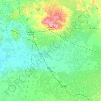
Name: Topografische Karte Campo de Criptana, Höhe, Relief.
Durchschnittliche Höhe: 658 m
Minimale Höhe: 625 m
Maximale Höhe: 775 m
The 13th century beginnings of the urban center were situated around a fortified position in the Cerro de La Paz, which served as a defensive outpost of the Castillo de Criptana. The topographical features of the area determined the formation of the city and its subsequent expansion into the plain to the south.