
Topografische Karte Red Earth Creek
Interaktive Karte
Klicken Sie auf die Karte, um die Höhe anzuzeigen.
Über diese Karte
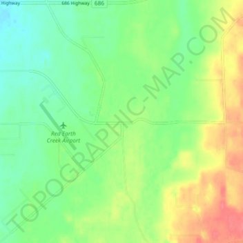
Name: Topografische Karte Red Earth Creek, Höhe, Relief.
Durchschnittliche Höhe: 549 m
Minimale Höhe: 526 m
Maximale Höhe: 584 m
Red Earth Creek is a hamlet in Alberta, Canada within the Municipal District of Opportunity No. 17. It is located east of Highway 88, between the Town of Slave Lake and the Hamlet of Fort Vermilion, and has an elevation of 520 metres (1,710 ft).