
Topografische Karte Pima Point
Interaktive Karte
Klicken Sie auf die Karte, um die Höhe anzuzeigen.
Über diese Karte
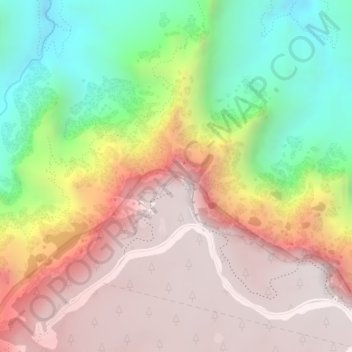
Name: Topografische Karte Pima Point, Höhe, Relief.
Durchschnittliche Höhe: 1.526 m
Minimale Höhe: 852 m
Maximale Höhe: 2.093 m
Andere topografische Karten
Klicken Sie auf eine Karte, um ihre Topografie, ihre Höhe und ihr Relief anzuzeigen.
South Rim
United States > Arizona > Coconino County > Grand Canyon Village
South Rim, Grand Canyon Village, Coconino County, Arizona, United States
Durchschnittliche Höhe: 1.858 m
Grand Canyon Village
United States > Arizona > Coconino County > Grand Canyon Village
Grand Canyon Village, Coconino County, Arizona, United States
Durchschnittliche Höhe: 1.764 m