
Topografische Karte Iowa City
Interaktive Karte
Klicken Sie auf die Karte, um die Höhe anzuzeigen.
Über diese Karte
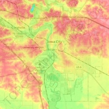
Name: Topografische Karte Iowa City, Höhe, Relief.
Ort: Iowa City, Johnson County, Iowa, United States of America (41.59855 -91.61579 41.69663 -91.46306)
Durchschnittliche Höhe: 216 m
Minimale Höhe: 163 m
Maximale Höhe: 254 m
The elevation at the Iowa City Municipal Airport is 668 ft (203.6 m) above sea level.