
Topografische Karte Hiriyur
Interaktive Karte
Klicken Sie auf die Karte, um die Höhe anzuzeigen.
Über diese Karte
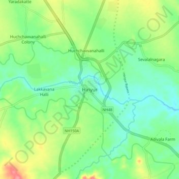
Name: Topografische Karte Hiriyur, Höhe, Relief.
Durchschnittliche Höhe: 613 m
Minimale Höhe: 585 m
Maximale Höhe: 668 m
Hiriyur is located at 13°57′N 76°37′E / 13.95°N 76.62°E / 13.95; 76.62. It has an average elevation of 630 metres (2066 feet). The months of March and April are the hottest months of the year.