
Topografische Karte Edmonson County
Interaktive Karte
Klicken Sie auf die Karte, um die Höhe anzuzeigen.
Über diese Karte
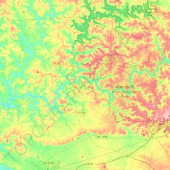
Name: Topografische Karte Edmonson County, Höhe, Relief.
Ort: Edmonson County, Kentucky, United States of America (37.05312 -86.46872 37.34086 -86.04896)
Durchschnittliche Höhe: 196 m
Minimale Höhe: 123 m
Maximale Höhe: 300 m
Andere topografische Karten
Klicken Sie auf eine Karte, um ihre Topografie, ihre Höhe und ihr Relief anzuzeigen.
Powell County
United States of America > Kentucky
Powell County, Kentucky, United States of America
Durchschnittliche Höhe: 293 m
Williamstown
United States of America > Kentucky > Williamstown
Williamstown, Grant County, Kentucky, 41097, United States of America
Durchschnittliche Höhe: 262 m
Cumberland County
United States of America > Kentucky
Cumberland County, Kentucky, United States of America
Durchschnittliche Höhe: 237 m