
Topografische Karte Wilmington
Interaktive Karte
Klicken Sie auf die Karte, um die Höhe anzuzeigen.
Wilmington
Wilmington experiences a humid continental climate (Koppen Dfb) with warm, humid summers and cold (sometimes severely cold) winters. While snowfall can vary greatly from year to year in nearby towns like Bennington and Brattleboro, Wilmington's snowfall is consistently heavy each year because of its elevation in the Green Mountains' high country.
Über diese Karte
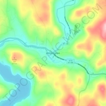
Name: Topografische Karte Wilmington, Höhe, Relief.
Ort: Wilmington, Windham County, Vermont, 05363, United States (42.84852 -72.89102 42.88852 -72.85102)
Durchschnittliche Höhe: 515 m
Minimale Höhe: 441 m
Maximale Höhe: 620 m