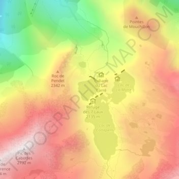
Topografische Karte Lac Carré
Interaktive Karte
Klicken Sie auf die Karte, um die Höhe anzuzeigen.
Über diese Karte
Name: Topografische Karte Lac Carré, Höhe, Relief.
Durchschnittliche Höhe: 2.160 m
Minimale Höhe: 1.462 m
Maximale Höhe: 2.687 m

Klicken Sie auf die Karte, um die Höhe anzuzeigen.
Name: Topografische Karte Lac Carré, Höhe, Relief.
Durchschnittliche Höhe: 2.160 m
Minimale Höhe: 1.462 m
Maximale Höhe: 2.687 m