
Topografische Karte Caracol
Interaktive Karte
Klicken Sie auf die Karte, um die Höhe anzuzeigen.
Über diese Karte
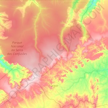
Name: Topografische Karte Caracol, Höhe, Relief.
Durchschnittliche Höhe: 575 m
Minimale Höhe: 384 m
Maximale Höhe: 736 m
Caracol is a large ancient Maya archaeological site, located in what is now the Cayo District, of Belize. It is situated approximately 40 kilometres (25 mi) south of Xunantunich, and the town of San Ignacio, and 15 km (9.3 mi) from the Macal River. It rests on the Vaca Plateau, at an elevation of 500 m (1,600 ft) above sea-level, in the foothills of the Maya Mountains. Long thought to be a tertiary center, it is now known that the site was one of the most important regional political centers of the Maya Lowlands during the Classic Period. Caracol covered approximately 200 square kilometres (77 sq mi), covering an area much larger than present-day Belize City, the largest metropolitan area in the country, and supported more than twice the modern city's population.