
Topografische Karte Porangatu
Interaktive Karte
Klicken Sie auf die Karte, um die Höhe anzuzeigen.
Porangatu
Important rivers are the Santa Tereza, Cana Brava, Ouro Pintado, Santa Maria and Gregório. The climate is hot, moist tropical, with frequent occurrences of a maximum of 40 °C. The average minimum is 21C, the maximum is 40 °C and the minimum is 21 °C. The elevation is 390 meters above sea level and the highest points are Serra da Sabina and Serra dos Picos.
Über diese Karte
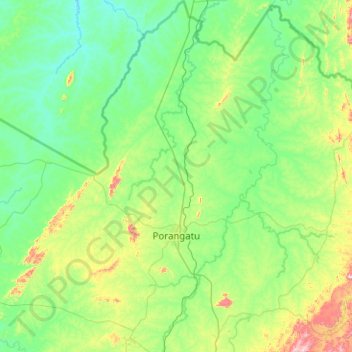
Name: Topografische Karte Porangatu, Höhe, Relief.
Durchschnittliche Höhe: 349 m
Minimale Höhe: 223 m
Maximale Höhe: 981 m