
Topografische Karte Monte Cimone
Interaktive Karte
Klicken Sie auf die Karte, um die Höhe anzuzeigen.
Über diese Karte
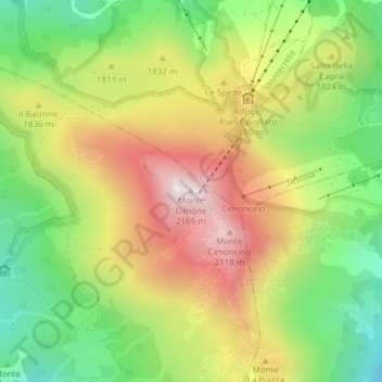
Name: Topografische Karte Monte Cimone, Höhe, Relief.
Durchschnittliche Höhe: 1.759 m
Minimale Höhe: 1.417 m
Maximale Höhe: 2.153 m
The mountain has an elevation of 2,165 m and is also the highest point in the Emilia-Romagna region of Italy.