

Topografische Karte River Lett
Klicken Sie auf die Karte, um die Höhe anzuzeigen.
Über diese Karte

Name: Topografische Karte River Lett, Höhe, Relief.
Durchschnittliche Höhe: 804 m
Minimale Höhe: 664 m
Maximale Höhe: 1.121 m
Andere topografische Karten
Klicken Sie auf eine Karte, um ihre Topografie, ihre Höhe und ihr Relief anzuzeigen.
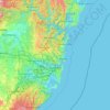
Sydney
Sydney's topography is characterized by a diverse landscape that seamlessly blends coastal features with inland plateaus. The city is divided into two primary regions: the relatively flat Cumberland Plain to the south and west of Sydney Harbour, and the elevated Hornsby Plateau to the north. The Cumberland…
Durchschnittliche Höhe: 51 m
Penrith
Australia > New South Wales > Sydney > Penrith
Penrith is a city in New South Wales, Australia, located in Greater Western Sydney, 55 kilometres (31 mi) west of the Sydney central business district on the banks of the Nepean River, on the outskirts of the Cumberland Plain. Its elevation is 32 metres (105 ft).
Durchschnittliche Höhe: 34 m
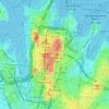
Sydney
Phillip had been given no instructions for urban development, but in July 1788 submitted a plan for the new town at Sydney Cove. It included a wide central avenue, a permanent Government House, law courts, hospital and other public buildings, but no provision for warehouses, shops, or other commercial…
Durchschnittliche Höhe: 32 m

Barrington Tops National Park
The climate varies from temperate on the lower altitudes to subalpine at highest elevations. A record low of −17 °C (1 °F) has been registered at 1,500 m (4,900 ft) above mean sea level. Rainfalls fluctuate between 750 millimetres (30 in) in the northwest to more than 2,000 mm (79 in) in the southeast.
Durchschnittliche Höhe: 736 m

Australian Alps
The Australian Alps are a mountain range in southeast Australia. It comprises an interim Australian bioregion, and is the highest mountain range in Australia. The range straddles the borders of eastern Victoria, southeastern New South Wales, and the Australian Capital Territory. It contains Australia's only…
Durchschnittliche Höhe: 2.037 m







Leura
Leura's elevation of 985 metres (3,232 ft) AHD leads to occasional snowfall in winter and a climate that reflects all four seasons distinctly.
Durchschnittliche Höhe: 880 m



Mount Kościuszko
Mount Kosciuszko is the highest summit in mainland Australia. Until 1977 it was possible to drive from Charlotte Pass to within a few metres of the summit, but in 1977 the road was closed to public motor vehicle access due to environmental concerns. The road is open from Charlotte Pass for walkers and cyclists…
Durchschnittliche Höhe: 2.035 m




Tumbarumba
Another site approximately 25 kilometres (16 mi) to the north-west of Tumbarumba operated from 1938 to 1997, at the Carabost Forest Headquarters. There is a remarkable warming trend to be observed between the two sites; particularly in the winter months, where Tumbarumba Post Office averages 10.8 °C (51.4…
Durchschnittliche Höhe: 774 m
Adaminaby
Another site 20 km to the north (Yaouk, since 1969) records significantly greater rainfall due to its higher elevation and proximity to the dividing range. This site is most representative of the areas situated on and around Lake Eucumbene. Rainfall total and pattern here approach those of Khancoban and very…
Durchschnittliche Höhe: 1.174 m





Byron Bay
Byron Bay, located in northeastern New South Wales, Australia, is characterized by diverse topography shaped by its geological history. The town is part of the erosion caldera of the ancient Tweed Volcano, which erupted approximately 23 million years ago, resulting in the rich volcanic soils that define the…
Durchschnittliche Höhe: 7 m
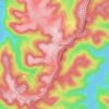
Berowra
Australia > New South Wales > Sydney
Berowra is located 44 kilometres north of the Sydney CBD and lies at an altitude of 215 metres. Surrounded by bushland, it borders the national parks of both the Berowra Valley and Ku-ring-gai Chase.
Durchschnittliche Höhe: 144 m
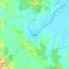
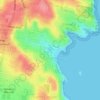


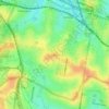





Blackheath
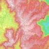
Blackheath (postcode: 2785) is an Australian town located near the highest point of the Blue Mountains, between Katoomba and Mount Victoria in New South Wales. The town's altitude is about 1,065 metres (3,494 ft) AHD and it is located about 120 kilometres (75 mi) west north-west of Sydney, 11 kilometres…
Durchschnittliche Höhe: 893 m




Michelago
Michelago is situated in a valley between two mountain ranges, the Tinderry Range to the East and the Clear Range to the west. The Tinderry Road crosses the Tinderry range from Michelago, leading ultimately to the 1950s silver mining settlement Captains Flat. The highest peaks in the picturesque Tinderry Range…
Durchschnittliche Höhe: 958 m