
Topografische Karte Llangorse Lake
Interaktive Karte
Klicken Sie auf die Karte, um die Höhe anzuzeigen.
Über diese Karte
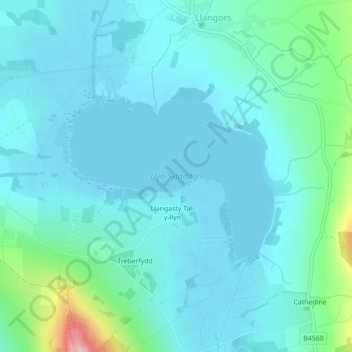
Name: Topografische Karte Llangorse Lake, Höhe, Relief.
Ort: Llangorse Lake, Llangors, Powys, Wales, United Kingdom (51.92203 -3.27606 51.93548 -3.25056)
Durchschnittliche Höhe: 177 m
Minimale Höhe: 150 m
Maximale Höhe: 327 m
The lake is a Site of Special Scientific Interest (SSSI) and has long been regarded as a place where fish and birds are found in unusually high numbers. Gerald of Wales (Giraldus Cambrensis) mentioned the abundance of waterfowl in his topographical work, The Description of Wales in the 12th century. It is a Special Area of Conservation (under the EU Habitats Directive) as an example of a natural nutrient-rich lake with pondweeds.