
Topografische Karte Zijkanaal G
Interaktive Karte
Klicken Sie auf die Karte, um die Höhe anzuzeigen.
Über diese Karte
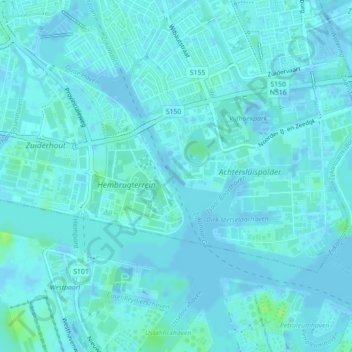
Name: Topografische Karte Zijkanaal G, Höhe, Relief.
Durchschnittliche Höhe: 2 m
Minimale Höhe: -7 m
Maximale Höhe: 10 m
Andere topografische Karten
Klicken Sie auf eine Karte, um ihre Topografie, ihre Höhe und ihr Relief anzuzeigen.
Centrum
Netherlands > North Holland > Amsterdam
Centrum, Amsterdam, North Holland, Netherlands, 1012 GC, Netherlands, Rokin
Durchschnittliche Höhe: 7 m
Gerbrandypark
Netherlands > North Holland > Amsterdam
Gerbrandypark, Nieuw-West, Amsterdam, North Holland, Netherlands
Durchschnittliche Höhe: 3 m
Sloten
Netherlands > North Holland > Amsterdam
Sloten, Amsterdam, North Holland, Netherlands, 1066 CZ, Netherlands
Durchschnittliche Höhe: 0 m
Sporenburg
Netherlands > North Holland > Amsterdam > Schellingwoude
Sporenburg, Schellingwoude, Amsterdam, North Holland, Netherlands
Durchschnittliche Höhe: 2 m
Vondelpark
Netherlands > North Holland > Amsterdam
Vondelpark, De Baarsjes, Amsterdam, North Holland, Netherlands
Durchschnittliche Höhe: 5 m
Borneo-eiland
Netherlands > North Holland > Amsterdam
Borneo-eiland, Amsterdam, North Holland, Netherlands
Durchschnittliche Höhe: 2 m
Slotervaart
Netherlands > North Holland > Amsterdam
Slotervaart, Amsterdam, North Holland, Netherlands, 1068SK, Netherlands
Durchschnittliche Höhe: 2 m