Geolokalisieren

Topografische Karte Alvelos

Klicken Sie auf die Karte, um die Höhe anzuzeigen.

Über diese Karte
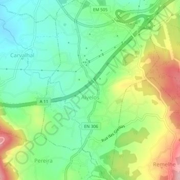
Name: Topografische Karte Alvelos, Höhe, Relief.

Ort: Alvelos, Barcelos, Braga, 4755-028, Portugal (41.49147 -8.63130 41.51871 -8.60733)

Durchschnittliche Höhe: 92 m

Minimale Höhe: 23 m

Maximale Höhe: 212 m

Andere topografische Karten

Klicken Sie auf eine Karte, um ihre Topografie, ihre Höhe und ihr Relief anzuzeigen.

Silveiros

Portugal > Braga > Barcelos

Durchschnittliche Höhe: 136 m

Fonte Coberta

Portugal > Braga > Barcelos

Durchschnittliche Höhe: 117 m

Monte do Facho

Portugal > Braga > Barcelos > Roriz

Durchschnittliche Höhe: 121 m

Vila Cova

Portugal > Braga > Barcelos

Durchschnittliche Höhe: 98 m

Feitos

Portugal > Braga > Barcelos

Durchschnittliche Höhe: 259 m

Milhazes

Portugal > Braga > Barcelos

Durchschnittliche Höhe: 83 m

Vilar do Monte

Portugal > Braga > Barcelos

Durchschnittliche Höhe: 165 m

Gonçalo

Portugal > Braga > Barcelos

Durchschnittliche Höhe: 347 m

Franqueira

Portugal > Braga > Barcelos

Durchschnittliche Höhe: 146 m

Martim de Além

Portugal > Braga > Barcelos > Martim

Durchschnittliche Höhe: 134 m

Durrães

Portugal > Braga > Barcelos

Durchschnittliche Höhe: 132 m

Gamil

Portugal > Braga > Barcelos

Durchschnittliche Höhe: 68 m

Rüsten Sie sich für Ihr nächstes Abenteuer:

📡Satelliten Notrufgerät - Sicherheitsgerät mit SOS‑Funktion weltweit
🧤Bergsteig‑Handschuhe - Wärmende und griffige Handschuhe für Bergtouren
🛏️Ultraleichte Isomatte - Gewichtsarme Matte für lange Touren
🧳Reisetasche mit Rollen - Große Reisetasche ideal für Outdoor‑Trips
🌙Schlafmaske Comfort - Für erholsamen Schlaf im Zelt

Als Amazon-Partner erhält diese Website eine Provision für qualifizierte Käufe, ohne zusätzliche Kosten für Sie.