
Topografische Karte Nagaur
Klicken Sie auf die Karte, um die Höhe anzuzeigen.
Nagaur
Nagaur is located at 27°12′N 73°44′E / 27.2°N 73.73°E / 27.2; 73.73. It has an average elevation of 302 metres (990 feet). Nagaur is situated amidst seven districts namely Bikaner, Churu, Sikar, Jaipur, Ajmer, Pali, Jodhpur. Nagaur is the fifth largest district in Rajasthan with a vast terrain spreading over 17,718 km2 (6,841 sq mi) Its geographical spread is a good combine of plain, hills, sand mounds and as such it is a part of the great Indian Thar Desert.
Über diese Karte
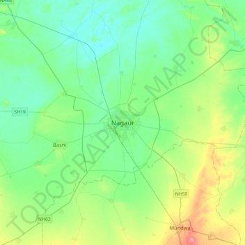
Name: Topografische Karte Nagaur, Höhe, Relief.
Durchschnittliche Höhe: 303 m
Minimale Höhe: 278 m
Maximale Höhe: 376 m