
Topografische Karte Montecalvo Irpino
Interaktive Karte
Klicken Sie auf die Karte, um die Höhe anzuzeigen.
Über diese Karte
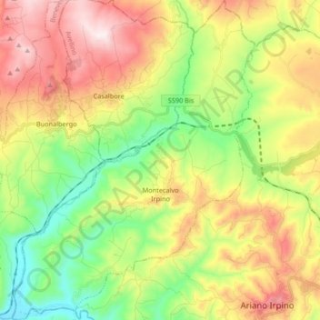
Name: Topografische Karte Montecalvo Irpino, Höhe, Relief.
Ort: Montecalvo Irpino, Avellino, Italy (41.14681 14.95692 41.27093 15.08208)
Durchschnittliche Höhe: 497 m
Minimale Höhe: 165 m
Maximale Höhe: 936 m
Montecalvo Irpino is located in the northern sector of the province of Avellino, on the border with Benevento. The municipality, built at an elevation of 2,044 ft (623 m) MSL, upstream of the confluence between the Miscano stream and the Ufita River, is part of the mountain community of Ufita. Its land is mostly clayey and tuffaceous, and is mainly mountainous. The municipal countryside covers an area of 20.67 sq mi (53.50 km2), with an altitude ranging from 151 to 700 m above sea level, with an excursion of 549 m.