
Topografische Karte Pulau Gureda
Interaktive Karte
Klicken Sie auf die Karte, um die Höhe anzuzeigen.
Über diese Karte
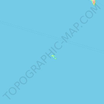
Name: Topografische Karte Pulau Gureda, Höhe, Relief.
Ort: Pulau Gureda, North Maluku, Indonesia (0.68000 125.81333 1.32000 126.45333)
Durchschnittliche Höhe: 0 m
Minimale Höhe: 0 m
Maximale Höhe: 346 m
Andere topografische Karten
Klicken Sie auf eine Karte, um ihre Topografie, ihre Höhe und ihr Relief anzuzeigen.
Mount Ibu
Indonesia > North Maluku > Halmahera Barat
Mount Ibu, Halmahera Barat, North Maluku, Maluku, Indonesia
Durchschnittliche Höhe: 951 m
Aketajawe Lolobata National Park
Indonesia > North Maluku > Halmahera Timur
Aketajawe Lolobata National Park, Halmahera Timur, North Maluku, Maluku, Indonesia
Durchschnittliche Höhe: 161 m
Tidore Kepulauan
Tidore Kepulauan, North Maluku, Maluku, Indonesia
Durchschnittliche Höhe: 84 m
Moti Island
Indonesia > North Maluku > Ternate
Moti Island, Ternate, North Maluku, Indonesia
Durchschnittliche Höhe: 146 m
Sasa
Indonesia > North Maluku > Sasa
Sasa, North Maluku, 97719, Indonesia
Durchschnittliche Höhe: 251 m
Halmahera
Halmahera, North Maluku, Maluku, Indonesia
Durchschnittliche Höhe: 46 m
Makete
Indonesia > North Maluku > Halmahera Utara
Makete, Halmahera Utara, North Maluku, Indonesia
Durchschnittliche Höhe: 32 m
Tidore
Indonesia > North Maluku > Tidore Kepulauan
Tidore, Tidore Kepulauan, North Maluku, Indonesia
Durchschnittliche Höhe: 152 m
Pulau Sibu
Indonesia > North Maluku > Ternate
Pulau Sibu, Ternate, North Maluku, Indonesia
Durchschnittliche Höhe: 133 m
Pulau Bacan
Pulau Bacan, North Maluku, Indonesia
Durchschnittliche Höhe: 127 m
Mangoli
Indonesia > North Maluku > Mangoli
Mangoli, Sula Islands, North Maluku, Indonesia
Durchschnittliche Höhe: 11 m
Bacan Island
Bacan Island, North Maluku, Indonesia
Durchschnittliche Höhe: 125 m