

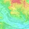
Topografische Karte Lyme Regis
Klicken Sie auf die Karte, um die Höhe anzuzeigen.
Lyme Regis
Lyme Regis is a coastal town in West Dorset, 25 miles (40 km) west of Dorchester and 25 miles (40 km) east of Exeter. It lies in Lyme Bay, on the English Channel coast at the Dorset–Devon border. At the 2011 census, it had a population of 3,671. The town has grown around the mouth of the River Lim (or Lym) which drops from a plateau at an altitude of about 200 m (660 ft) before flowing around 5–6 km (3–4 mi) south and south-east to the sea. Its name is of British origin and probably cognate with the Welsh llif meaning flood or stream. Historically there were mills along its length. Its lower reaches coincide with sections of three recreational footpaths: the Wessex Ridgeway, Liberty Trail and East Devon Trail.
Über diese Karte

Name: Topografische Karte Lyme Regis, Höhe, Relief.
Ort: Lyme Regis, Dorset, England, United Kingdom (50.71799 -2.95310 50.75428 -2.91578)
Durchschnittliche Höhe: 83 m
Minimale Höhe: 0 m
Maximale Höhe: 205 m
Andere topografische Karten
Klicken Sie auf eine Karte, um ihre Topografie, ihre Höhe und ihr Relief anzuzeigen.





Lulworth Castle
United Kingdom > England > Dorset > Wareham > East Lulworth
Durchschnittliche Höhe: 70 m

Frampton (Millennium Green)
United Kingdom > England > Dorset > Frampton
Durchschnittliche Höhe: 111 m


Lower Blandford St Mary
United Kingdom > England > Dorset > Blandford St. Mary
Durchschnittliche Höhe: 58 m




Middlemarsh
United Kingdom > England > Dorset > Glanvilles Wootton > Middlemarsh
Durchschnittliche Höhe: 116 m


River Frome
United Kingdom > England > Dorset > Maiden Newton > Frome Vauchurch
Durchschnittliche Höhe: 132 m

South Admiston
United Kingdom > England > Dorset > Athelhampton > South Admiston
Durchschnittliche Höhe: 64 m










Denhay Hill or Jan's Hill
United Kingdom > England > Dorset > North Chideock
Durchschnittliche Höhe: 69 m


Fishpond Bottom
United Kingdom > England > Dorset > Whitchurch Canonicorum
Durchschnittliche Höhe: 129 m

