Topografische Karte Sonari
Klicken Sie auf die Karte, um die Höhe anzuzeigen.
Sonari
Sonari is located at 27°04′N 95°02′E / 27.07°N 95.03°E / 27.07; 95.03. It has an average elevation of 97 metres (318 feet). It is a major town on the nearly 500-year-old "Dhodar Ali" built by the Ahom Kings. Dhodar ali was forcefully commissioned by Ahom king Gadadhar Singha using the so-called lazy people or the socially unproductive 'Dhods' residing within Assam. Situated by the side of the Taokak river, Sonari is the headquarters of Charaideo District, Assam. The nearest railway station is Bhojo, which is about 3 km away located by the bank of historical Disang River. The best way to reach Sonari by road is from Sivasagar town through the Dhodar Ali near which the famous royal mausoleum of the Ahom Kings at Charaideo is situated. Sonari is a centre for tea and timber industries and is the gateway to the Mon district of Nagaland.
Über diese Karte
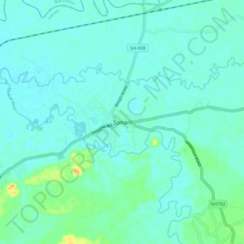
Name: Topografische Karte Sonari, Höhe, Relief.
Ort: Sonari, Charaideo, Assam, 785690, India (26.98670 94.97833 27.06670 95.05833)
Durchschnittliche Höhe: 106 m
Minimale Höhe: 99 m
Maximale Höhe: 138 m
Andere topografische Karten
Klicken Sie auf eine Karte, um ihre Topografie, ihre Höhe und ihr Relief anzuzeigen.