
Topografische Karte Mornos Artificial Lake
Interaktive Karte
Klicken Sie auf die Karte, um die Höhe anzuzeigen.
Über diese Karte
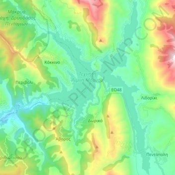
Name: Topografische Karte Mornos Artificial Lake, Höhe, Relief.
Durchschnittliche Höhe: 672 m
Minimale Höhe: 283 m
Maximale Höhe: 1.708 m
Andere topografische Karten
Klicken Sie auf eine Karte, um ihre Topografie, ihre Höhe und ihr Relief anzuzeigen.
Dytiki Soufla
Greece > Thessaly and Central Greece > Regional Unit of Phocis > Municipal Unit of Vardousia
Dytiki Soufla, Municipal Unit of Vardousia, Dorida Municipality, Regional Unit of Phocis, Central Greece, Thessaly and Central Greece, Greece
Durchschnittliche Höhe: 1.893 m