

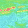
Topografische Karte Jerry Lake
Klicken Sie auf die Karte, um die Höhe anzuzeigen.
Über diese Karte

Name: Topografische Karte Jerry Lake, Höhe, Relief.
Durchschnittliche Höhe: 380 m
Minimale Höhe: 355 m
Maximale Höhe: 422 m
Andere topografische Karten
Klicken Sie auf eine Karte, um ihre Topografie, ihre Höhe und ihr Relief anzuzeigen.


Tatachikapika Lake
Canada > Ontario > Sudbury District > Unorganized North Sudbury
Durchschnittliche Höhe: 385 m

Cooper Falls
Canada > Ontario > Sudbury District > Unorganized North Sudbury
Durchschnittliche Höhe: 348 m


Mattagami Lake
Canada > Ontario > Sudbury District > Unorganized North Sudbury > Mattagami
Durchschnittliche Höhe: 368 m

Nepewassi Lake
Canada > Ontario > Sudbury District > Unorganized North Sudbury
Durchschnittliche Höhe: 223 m

Onaping Lake
Canada > Ontario > Sudbury District > Unorganized North Sudbury
Durchschnittliche Höhe: 428 m

Ridout Lake
Canada > Ontario > Sudbury District > Unorganized North Sudbury
Durchschnittliche Höhe: 409 m

Halfway Lake Provincial Park
Canada > Ontario > Sudbury District > Unorganized North Sudbury
Durchschnittliche Höhe: 440 m


Shining Tree
Canada > Ontario > Sudbury District > Unorganized North Sudbury
Durchschnittliche Höhe: 383 m

Bennet Lake
Canada > Ontario > Sudbury District > Unorganized North Sudbury
Durchschnittliche Höhe: 418 m

Dividing Lake
Canada > Ontario > Sudbury District > Unorganized North Sudbury
Durchschnittliche Höhe: 391 m

Low Water Lake
Canada > Ontario > Sudbury District > Unorganized North Sudbury
Durchschnittliche Höhe: 427 m
Whitefish Falls
Canada > Ontario > Sudbury District > Unorganized North Sudbury
Durchschnittliche Höhe: 205 m

Birch Island
Canada > Ontario > Sudbury District > Unorganized North Sudbury
Durchschnittliche Höhe: 376 m

Edna Lake
Canada > Ontario > Sudbury District > Unorganized North Sudbury
Durchschnittliche Höhe: 413 m

Spanish Chutes
Canada > Ontario > Sudbury District > Unorganized North Sudbury
Durchschnittliche Höhe: 425 m

Ishpatina Ridge Fire Tower
Canada > Ontario > Sudbury District > Unorganized North Sudbury
Durchschnittliche Höhe: 545 m

McLennan Creek;Moodie Lake
Canada > Ontario > Sudbury District > Unorganized North Sudbury
Durchschnittliche Höhe: 456 m

Spanish River Provincial Park
Canada > Ontario > Sudbury District > Unorganized North Sudbury
Durchschnittliche Höhe: 410 m

Willisville
Canada > Ontario > Sudbury District > Unorganized North Sudbury > Whitefish Falls
Durchschnittliche Höhe: 219 m

Wakami Lake
Canada > Ontario > Sudbury District > Unorganized North Sudbury
Durchschnittliche Höhe: 466 m

West Shining Tree Lake
Canada > Ontario > Sudbury District > Unorganized North Sudbury > Shining Tree
Durchschnittliche Höhe: 380 m

Singelake
Canada > Ontario > Sudbury District > Unorganized North Sudbury
Durchschnittliche Höhe: 344 m

Ministic Lake
Canada > Ontario > Sudbury District > Unorganized North Sudbury
Durchschnittliche Höhe: 384 m

Laforest
Canada > Ontario > Sudbury District > Unorganized North Sudbury
Durchschnittliche Höhe: 406 m

Ishpatina Ridge
Canada > Ontario > Sudbury District > Unorganized North Sudbury
Ishpatina Ridge is the highest point of land in the Canadian province of Ontario, at an estimated 693 m (2,274 ft) above sea level. Ishpatina Ridge rises approximately 300 m (984 ft) above the immediate area. It was only truly recognized as Ontario's highest point after topographical mapping by the Government…
Durchschnittliche Höhe: 545 m

Minisinakwa Lake
Canada > Ontario > Sudbury District > Unorganized North Sudbury > Gogama
Durchschnittliche Höhe: 376 m