
Topografische Karte Orange County
Interaktive Karte
Klicken Sie auf die Karte, um die Höhe anzuzeigen.
Orange County
The geography of Orange County varies relatively little, with an elevation that reaches 33 ft (10 m) above sea level at very few points within the county. Orange County is very flat, and its soil is quite sandy, as could be expected in a county along the Gulf of Mexico. (Sandy soil is also common in southern Louisiana, Mississippi, and Alabama, and in western and southern Florida.) Saltwater marshes occur in much of the southeastern part of Orange County that borders the Sabine River. The Piney Woods are in the northern part of the county.
Über diese Karte
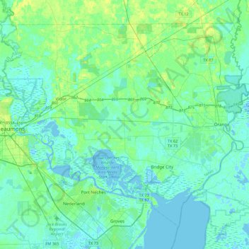
Name: Topografische Karte Orange County, Höhe, Relief.
Ort: Orange County, Texas, United States (29.93988 -94.11890 30.24266 -93.68843)
Durchschnittliche Höhe: 4 m
Minimale Höhe: -6 m
Maximale Höhe: 17 m