Geolokalisieren

Topografische Karte Indirapuram

Interaktive Karte

Klicken Sie auf die Karte, um die Höhe anzuzeigen.

Über diese Karte

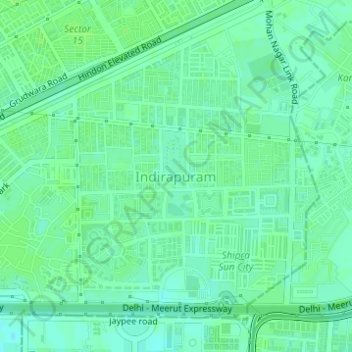
Name: Topografische Karte Indirapuram, Höhe, Relief.

Ort: Indirapuram, Ghaziabad, Uttar Pradesh, 201001, India (28.63239 77.35849 28.65239 77.37849)

Durchschnittliche Höhe: 204 m

Minimale Höhe: 199 m

Maximale Höhe: 207 m

Andere topografische Karten

Klicken Sie auf eine Karte, um ihre Topografie, ihre Höhe und ihr Relief anzuzeigen.

B Block Park Ramprastha Colony

India > Uttar Pradesh > Ghaziabad

B Block Park Ramprastha Colony, Chander Nagar, Kaushambi, Ghaziabad, Uttar Pradesh, 201001, India

Durchschnittliche Höhe: 206 m

Teacher Colony

India > Uttar Pradesh > Ghaziabad

Teacher Colony, Ghaziabad, Uttar Pradesh, 201001, India

Durchschnittliche Höhe: 208 m

JATWARA

India > Uttar Pradesh > Ghaziabad

JATWARA, Ghaziabad, Uttar Pradesh, 201001, India

Durchschnittliche Höhe: 215 m

Patel Nagar

India > Uttar Pradesh > Ghaziabad

Patel Nagar, Ghaziabad, Uttar Pradesh, 201001, India

Durchschnittliche Höhe: 212 m