
Topografische Karte Paonta Sahib
Klicken Sie auf die Karte, um die Höhe anzuzeigen.
Paonta Sahib
Paonta Sahib is located at 30°26′17″N 77°37′26″E / 30.438°N 77.624°E / 30.438; 77.624. It has an average elevation of 389 metres (1,276 feet). It is on the bank of the river Yamuna, the river being the boundary between the states of Himachal Pradesh and Uttarakhand. It is situated near the towns of Nahan in Himachal Pradesh, Yamunanagar in Haryana, Saharanpur in Western Uttar Pradesh and Dehradun in Uttarakhand. It is on the western extreme of the Doon Valley, which is at a distance of about 44 km from Dehradun. Kalesar National Park is 12 km from Paonta Sahib. Colonel Sher Jung National Park is around 7 km from the main town. Some luxury hotels to stay in Paonta Sahib are Hotel Guru Surbhi, Hotel Yamuna, and Hotel Paonta Valley.
Über diese Karte
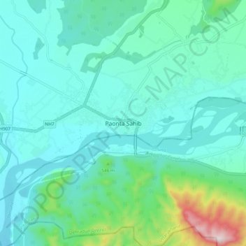
Name: Topografische Karte Paonta Sahib, Höhe, Relief.
Durchschnittliche Höhe: 443 m
Minimale Höhe: 356 m
Maximale Höhe: 864 m