
Topografische Karte Aigle
Interaktive Karte
Klicken Sie auf die Karte, um die Höhe anzuzeigen.
Aigle
Aigle lies at an elevation of 415 m (1,362 ft) about 13 km (8.1 mi) south-southeast of Montreux. It is on the east edge of the Rhône valley, at the foot of the Swiss Alps.
Über diese Karte
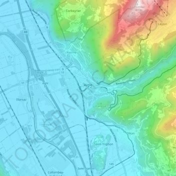
Name: Topografische Karte Aigle, Höhe, Relief.
Ort: Aigle, District d'Aigle, Vaud, 1860, Switzerland (46.29131 6.93177 46.34167 7.04028)
Durchschnittliche Höhe: 647 m
Minimale Höhe: 371 m
Maximale Höhe: 1.948 m
Andere topografische Karten
Klicken Sie auf eine Karte, um ihre Topografie, ihre Höhe und ihr Relief anzuzeigen.