
Topografische Karte Stanwell Tops Lookout
Interaktive Karte
Klicken Sie auf die Karte, um die Höhe anzuzeigen.
Über diese Karte
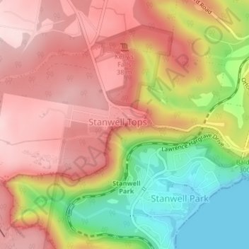
Name: Topografische Karte Stanwell Tops Lookout, Höhe, Relief.
Durchschnittliche Höhe: 172 m
Minimale Höhe: 0 m
Maximale Höhe: 292 m
Andere topografische Karten
Klicken Sie auf eine Karte, um ihre Topografie, ihre Höhe und ihr Relief anzuzeigen.
Mount Pleasant
Australia > New South Wales > Wollongong City Council
Mount Pleasant, Wollongong City Council, New South Wales, 2519, Australia
Durchschnittliche Höhe: 140 m
Stanwell Park
Australia > New South Wales > Wollongong City Council
Stanwell Park, Wollongong City Council, New South Wales, 2508, Australia
Durchschnittliche Höhe: 96 m