
Topografische Karte Rupandehi
Interaktive Karte
Klicken Sie auf die Karte, um die Höhe anzuzeigen.
Rupandehi
The district lies on the southern and western part of Nepal. On the East it shares border with Nawalparasi District, on West with Kapilvastu District, on North with Palpa District and on South with India. The elevation of the district lies between 100m to 1229m from sea level. The total area of the district is 1,360 km2 with 16.1% in Churia Range and rest in the Terai region.
Über diese Karte
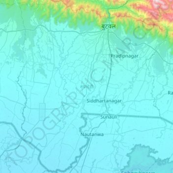
Name: Topografische Karte Rupandehi, Höhe, Relief.
Ort: Rupandehi, Lumbini Province, Nepal (27.33016 83.20425 27.76729 83.63440)
Durchschnittliche Höhe: 182 m
Minimale Höhe: 86 m
Maximale Höhe: 1.800 m
Andere topografische Karten
Klicken Sie auf eine Karte, um ihre Topografie, ihre Höhe und ihr Relief anzuzeigen.