Geolokalisieren

Topografische Karte Bashaw

Interaktive Karte

Klicken Sie auf die Karte, um die Höhe anzuzeigen.

Über diese Karte

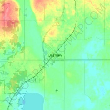
Name: Topografische Karte Bashaw, Höhe, Relief.

Ort: Bashaw, Division No. 10, Alberta, T0B 0H0, Canada (52.54333 -113.00667 52.62333 -112.92667)

Durchschnittliche Höhe: 796 m

Minimale Höhe: 776 m

Maximale Höhe: 846 m

Andere topografische Karten

Klicken Sie auf eine Karte, um ihre Topografie, ihre Höhe und ihr Relief anzuzeigen.

Village of Innisfree

Canada > Alberta > Division No. 10

Village of Innisfree, Division No. 10, Alberta, T0B 2G0, Canada

Durchschnittliche Höhe: 679 m

Meeting Creek

Canada > Alberta > Division No. 10

Meeting Creek, Division No. 10, Alberta, Canada

Durchschnittliche Höhe: 763 m

Town of Vegreville

Canada > Alberta > Division No. 10

Town of Vegreville, Division No. 10, Alberta, Canada

Durchschnittliche Höhe: 638 m

Village of Myrnam

Canada > Alberta > Division No. 10

Village of Myrnam, Division No. 10, Alberta, Canada

Durchschnittliche Höhe: 609 m

Camrose

Canada > Alberta > Division No. 10

Camrose, Division No. 10, Alberta, Canada

Durchschnittliche Höhe: 746 m

Vermilion

Canada > Alberta > Division No. 10

Vermilion, Division No. 10, Alberta, T9X 1B7, Canada

Durchschnittliche Höhe: 616 m