
Topografische Karte Loch Katrine
Interaktive Karte
Klicken Sie auf die Karte, um die Höhe anzuzeigen.
Über diese Karte
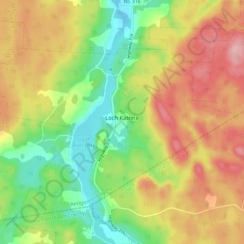
Name: Topografische Karte Loch Katrine, Höhe, Relief.
Durchschnittliche Höhe: 126 m
Minimale Höhe: 49 m
Maximale Höhe: 211 m
Andere topografische Karten
Klicken Sie auf eine Karte, um ihre Topografie, ihre Höhe und ihr Relief anzuzeigen.
Tracadie
Canada > Nouvelle-Écosse > Municipality of the County of Antigonish
Tracadie, Municipality of the County of Antigonish, Antigonish County, Nouvelle-Écosse, Canada
Durchschnittliche Höhe: 17 m
Georgeville
Canada > Nouvelle-Écosse > Municipality of the County of Antigonish
Georgeville, Municipality of the County of Antigonish, Antigonish County, Nouvelle-Écosse, Canada
Durchschnittliche Höhe: 66 m