Geolokalisieren

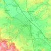
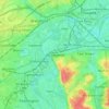
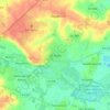
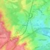
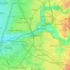
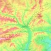
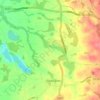
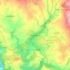
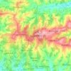
Topografische Karte Coventry

Klicken Sie auf die Karte, um die Höhe anzuzeigen.

Über diese Karte
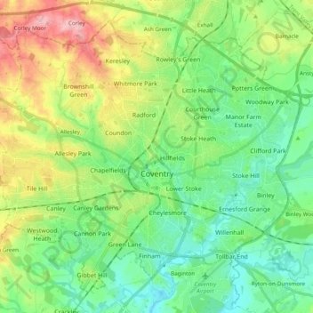
Name: Topografische Karte Coventry, Höhe, Relief.

Ort: Coventry, West Midlands, England, United Kingdom (52.36394 -1.61446 52.46478 -1.42396)

Durchschnittliche Höhe: 99 m

Minimale Höhe: 58 m

Maximale Höhe: 182 m

Andere topografische Karten

Klicken Sie auf eine Karte, um ihre Topografie, ihre Höhe und ihr Relief anzuzeigen.
London

United Kingdom > England > London

Durchschnittliche Höhe: 42 m

Cambridge

United Kingdom > England > Cambridge

The city, like most of the UK, has a maritime climate highly influenced by the Gulf Stream. Located in the driest region of Britain, Cambridge's rainfall averages around 570 mm (22.44 in) per year, around half the national average, with some years occasionally falling into the semi-arid (under 500 mm (19.69…

Durchschnittliche Höhe: 18 m
Portishead

United Kingdom > England > Portishead

Durchschnittliche Höhe: 26 m

Milton Keynes

United Kingdom > England > Milton Keynes > Milton Keynes

Durchschnittliche Höhe: 81 m

Exeter

United Kingdom > England > Devon > Exeter

The city of Exeter was established on the eastern bank of the River Exe on a ridge of land backed by a steep hill. It is at this point that the Exe, having just been joined by the River Creedy, opens onto a wide flood plain and estuary which results in quite common flooding. Historically this was the lowest…

Durchschnittliche Höhe: 99 m

Royston

United Kingdom > England > North Hertfordshire > Royston

Durchschnittliche Höhe: 78 m

Peterborough

United Kingdom > England > Cambridgeshire

The local topography is flat, and in some places, the land lies below sea level, for example in parts of the Fens to the east and to the south of Peterborough. Human settlement in the area began before the Bronze Age, as can be seen at the Flag Fen archaeological site to the east of the current city centre,…

Durchschnittliche Höhe: 17 m
Leeds

United Kingdom > England

Lying in the eastern foothills of the Pennines, there is a significant variation in elevation within the city's built-up area. The district ranges from 1,115 feet (340 m) in the far west on the slopes of Ilkley Moor to about 33 feet (10 m) where the rivers Aire and Wharfe cross the eastern boundary. Land rises…

Durchschnittliche Höhe: 94 m
Rye

United Kingdom > England > Rother > Rye

Durchschnittliche Höhe: 12 m

Bexhill-on-Sea

United Kingdom > England > East Sussex > Rother

Durchschnittliche Höhe: 13 m

Bradford

United Kingdom > England

Bradford is located at 53°45′00″N 01°50′00″W / 53.75000°N 1.83333°W / 53.75000; -1.83333 (53.7500, -1.8333)1. Topographically, it is located in the eastern moorland region of the South Pennines.

Durchschnittliche Höhe: 167 m
Greenwich Park

United Kingdom > England > Greater London

Durchschnittliche Höhe: 22 m

Tyne and Wear

United Kingdom > England

Durchschnittliche Höhe: 144 m

Loughborough

United Kingdom > England > Leicestershire > Charnwood

Durchschnittliche Höhe: 61 m

Hull

United Kingdom > England > Kingston upon Hull

Kingston upon Hull is on the northern bank of the Humber Estuary. The city centre is west of the River Hull and close to the Humber. The city is built upon alluvial and glacial deposits which overlie chalk rocks but the underlying chalk has no influence on the topography. The land within the city is generally…

Durchschnittliche Höhe: 21 m

Ponderosa

United Kingdom > England > Sheffield

Durchschnittliche Höhe: 113 m

Fareham

United Kingdom > England > Hampshire > Fareham

Durchschnittliche Höhe: 20 m

Guildford

United Kingdom > England > Surrey > Guildford

Durchschnittliche Höhe: 64 m

Kinder Scout

United Kingdom > England > Derbyshire > High Peak

To the north across the Snake Pass lie the high moors of Bleaklow and Black Hill, which are of similar elevation.

Durchschnittliche Höhe: 555 m

Kingsbridge

United Kingdom > England > Kingsbridge

Durchschnittliche Höhe: 63 m

East Grinstead

United Kingdom > England > Mid Sussex > East Grinstead

Durchschnittliche Höhe: 96 m

Richmond

United Kingdom > England > London

The town centre lies just below 33 ft (10m) above sea level. South of the town centre, rising from Richmond Bridge to an elevation of 165 ft (50m), is Richmond Hill. Just beyond the summit of Richmond Hill is Richmond Park, an area of 2,360 acres (9.55 km2; 3.7 sq mi) of wild heath and woodland originally…

Durchschnittliche Höhe: 17 m
Bromley

United Kingdom > England > Greater London

Durchschnittliche Höhe: 62 m

Nenthead

United Kingdom > England > Westmorland and Furness

Durchschnittliche Höhe: 535 m

Grendon

United Kingdom > England > Warwickshire > North Warwickshire

Durchschnittliche Höhe: 95 m

Ashford

United Kingdom > England > Kent > Ashford

Durchschnittliche Höhe: 49 m

West Thirston

United Kingdom > England > Northumberland > Felton

Durchschnittliche Höhe: 56 m

Harting Down

United Kingdom > England > West Sussex > Chichester

Durchschnittliche Höhe: 137 m

Buxworth

United Kingdom > England > Derbyshire > High Peak

Durchschnittliche Höhe: 236 m

Cleeve Hill

United Kingdom > England > Gloucestershire > Tewkesbury

Durchschnittliche Höhe: 272 m

Draycott

United Kingdom > England > Derbyshire > Erewash

Durchschnittliche Höhe: 42 m

St Ives

United Kingdom > England > Huntingdonshire > St Ives

Durchschnittliche Höhe: 18 m

Bagshot

United Kingdom > England > Surrey > Surrey Heath

Durchschnittliche Höhe: 80 m

Ashmore Green

United Kingdom > England > West Berkshire > Cold Ash

Durchschnittliche Höhe: 108 m

Dereham

United Kingdom > England > Breckland > Dereham

Durchschnittliche Höhe: 54 m

Glastonbury

United Kingdom > England > Glastonbury

Durchschnittliche Höhe: 14 m

Redhill

United Kingdom > England > Surrey > Reigate and Banstead

To the north, the town joins with the village of Merstham, north of which there is a "wind gap" in the chalk hills of the North Downs, at an elevation of 120 metres (390 ft) above sea level, through which the A23 road heads in from London. Geologists have speculated that there may once have been a…

Durchschnittliche Höhe: 107 m

Wombourne

United Kingdom > England > Staffordshire > South Staffordshire

Durchschnittliche Höhe: 106 m
York

United Kingdom > England > York

Durchschnittliche Höhe: 21 m

Brighton

United Kingdom > England > Brighton and Hove

Durchschnittliche Höhe: 64 m

Torquay

United Kingdom > England > Torbay

Durchschnittliche Höhe: 31 m

Christ's Pieces

United Kingdom > England > Cambridgeshire > Cambridge

Durchschnittliche Höhe: 15 m

Sutterton

United Kingdom > England > Lincolnshire > Boston

Durchschnittliche Höhe: 4 m

Tadworth

United Kingdom > England > Surrey > Reigate and Banstead

Durchschnittliche Höhe: 159 m

Manthorpe

United Kingdom > England > Lincolnshire > South Kesteven

Durchschnittliche Höhe: 72 m

Blackborough

United Kingdom > England > Devon > Mid Devon

Durchschnittliche Höhe: 188 m

Stockport

United Kingdom > England > Stockport

Durchschnittliche Höhe: 71 m

Wakefield

United Kingdom > England

Durchschnittliche Höhe: 92 m

Jugger Howe Moor

United Kingdom > England > North Yorkshire

Durchschnittliche Höhe: 168 m

Witchford

United Kingdom > England > East Cambridgeshire > Witchford

Durchschnittliche Höhe: 8 m

Headington Hill Park

United Kingdom > England > Oxford

Durchschnittliche Höhe: 74 m

Blean

United Kingdom > England > Kent > Canterbury

Durchschnittliche Höhe: 66 m

Aldeburgh

United Kingdom > England > Aldeburgh

Durchschnittliche Höhe: 3 m

Boroughbridge

United Kingdom > England > Boroughbridge

Durchschnittliche Höhe: 27 m

Portsmouth

United Kingdom > England > Hampshire > Portsmouth

By road, Portsmouth lies 73.5 miles (118.3 km) from Central London, 49.5 miles (79.7 km) west of Brighton, and 22.3 miles (35.9 km) east of Southampton. Portsmouth is situated primarily on Portsea Island and is the United Kingdom's only island city, although parts of it have expanded onto the mainland. Gosport…

Durchschnittliche Höhe: 28 m

Truro

United Kingdom > England > Truro

Durchschnittliche Höhe: 65 m

Salisbury

United Kingdom > England > Salisbury

Bishop of Salisbury Hubert Walter was instrumental in the negotiations with Saladin during the Third Crusade, but he spent little time in his diocese prior to his elevation to archbishop of Canterbury. The brothers Herbert and Richard Poore succeeded him and began planning the relocation of the cathedral into…

Durchschnittliche Höhe: 96 m

Plymouth

United Kingdom > England > Devon > Plymouth

The River Plym, which flows off Dartmoor to the north-east, forms a smaller estuary to the east of the city called Cattewater. Plymouth Sound is protected from the sea by the Plymouth Breakwater, in use since 1814. In the Sound is Drake's Island which is seen from Plymouth Hoe, a flat public area on top of…

Durchschnittliche Höhe: 81 m

Cockleford

United Kingdom > England > Gloucestershire > Cotswold District > Cowley

Durchschnittliche Höhe: 233 m

West Park Field

United Kingdom > England > Leeds

Durchschnittliche Höhe: 96 m

Sixpenny Handley

United Kingdom > England > Dorset

Durchschnittliche Höhe: 97 m

Dudley

United Kingdom > England > Dudley

Durchschnittliche Höhe: 157 m

Brean Down

United Kingdom > England > Somerset

Durchschnittliche Höhe: 3 m

Capesthorne

United Kingdom > England > Cheshire East > Siddington

Durchschnittliche Höhe: 93 m

Erith

United Kingdom > England

Durchschnittliche Höhe: 17 m

Wellingborough

United Kingdom > England > North Northamptonshire

Durchschnittliche Höhe: 76 m

Shaw

United Kingdom > England > Oldham

Described in Samuel Lewis's A Topographical Dictionary of England (1848) as located in "a bleak situation", Shaw and Crompton is in the valley of the River Beal, which runs northward through the town towards the village of Newhey. The land to the east of the town steadily rises, reaching a height of 1,283 feet…

Durchschnittliche Höhe: 224 m

Tavistock

United Kingdom > England > West Devon > Tavistock

Durchschnittliche Höhe: 155 m

Knutsford

United Kingdom > England > Knutsford

Durchschnittliche Höhe: 54 m

Wallasey

United Kingdom > England

Wallasey is situated at the north-east of the Wirral Peninsula, on the western side of the River Mersey and adjoining the Irish Sea. The area is approximately 9.5 km (5.9 mi) east-north-east of the Dee Estuary at Hoylake. Wallasey is at an elevation of between 0–50 m (0–164 ft) above sea level, with the…

Durchschnittliche Höhe: 12 m

Louth

United Kingdom > England > Louth

Durchschnittliche Höhe: 50 m

Horwich

United Kingdom > England > Bolton

Durchschnittliche Höhe: 177 m

Wisbech

United Kingdom > England > Fenland > Wisbech

Durchschnittliche Höhe: 3 m

Hitchin

United Kingdom > England > Hertfordshire > North Hertfordshire

Durchschnittliche Höhe: 89 m

Heathfield

United Kingdom > England > East Sussex > Wealden

Durchschnittliche Höhe: 99 m

Ainsdale-on-Sea

United Kingdom > England

Durchschnittliche Höhe: 8 m

Cleethorpes

United Kingdom > England > North East Lincolnshire

Durchschnittliche Höhe: 4 m

Taunton

United Kingdom > England > Somerset

Durchschnittliche Höhe: 39 m

Kingston upon Thames

United Kingdom > England > Greater London

Durchschnittliche Höhe: 19 m

Chantmarle

United Kingdom > England > Dorset > Frome St Quintin

Durchschnittliche Höhe: 169 m

Bloxwich

United Kingdom > England

Durchschnittliche Höhe: 146 m

Spartylea

United Kingdom > England > Northumberland

Durchschnittliche Höhe: 420 m

Dover

United Kingdom > England > Kent > Dover

Durchschnittliche Höhe: 51 m

Lower Bowdley

United Kingdom > England > Devon > Teignbridge > Ashburton

Durchschnittliche Höhe: 214 m

Triscombe

United Kingdom > England > Somerset > West Bagborough

Durchschnittliche Höhe: 216 m

Cogden Hall

United Kingdom > England > North Yorkshire > Grinton

Durchschnittliche Höhe: 293 m

Darnholme

United Kingdom > England > North Yorkshire > Goathland

Durchschnittliche Höhe: 173 m

North Elmsall

United Kingdom > England > Wakefield

Durchschnittliche Höhe: 51 m

Winchester

United Kingdom > England > Hampshire

Durchschnittliche Höhe: 81 m

Lizard Point

United Kingdom > England > Cornwall > Lizard > Landewednack

Durchschnittliche Höhe: 17 m

Cheltenham

United Kingdom > England > Gloucestershire > Cheltenham

Durchschnittliche Höhe: 106 m

Neatham

United Kingdom > England > Hampshire > East Hampshire > Alton > Holybourne

Durchschnittliche Höhe: 122 m
Leighterton

United Kingdom > England > Gloucestershire > Cotswold District

Durchschnittliche Höhe: 166 m

Rüsten Sie sich für Ihr nächstes Abenteuer:

⛺Biwaksäcke - Minimalistischer Wetterschutz für Übernachtungen am Berg
🔥Ultraleichter Campingkocher - Kompaktes Kochsystem für Rucksacktouren
🔭Laser-Entfernungsmesser - Präzise Distanzmessung im Gelände per Knopfdruck
👖Trekkinghose für Herren - Bequeme Outdoorhose mit vielen Taschen
🦟Insektenschutzmittel - Effektive Abwehr von Zecken und Mücken im Wald

Als Amazon-Partner erhält diese Website eine Provision für qualifizierte Käufe, ohne zusätzliche Kosten für Sie.