
Topografische Karte Puurs
Interaktive Karte
Klicken Sie auf die Karte, um die Höhe anzuzeigen.
Über diese Karte
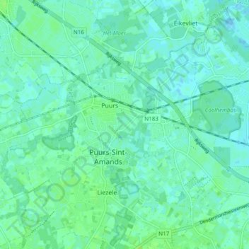
Name: Topografische Karte Puurs, Höhe, Relief.
Durchschnittliche Höhe: 4 m
Minimale Höhe: -1 m
Maximale Höhe: 9 m
Puurs sits about 5 meters above mean sea level. Its geography shows only minor elevation differences. Puurs is mainly rural, with some low intensity industry development in the North alongside the N16 expressway. However, because of its proximity to the cities of Antwerp and Brussels (both within a 25 km (16 mi) radius) and its excellent accessibility, Puurs is developing increasingly into a residential town.