

Topografische Karte Kanhangad
Klicken Sie auf die Karte, um die Höhe anzuzeigen.
Kanhangad
Kanhangad lies at 12°18′0″N 75°5.4′0″E in the geographic map of Kasaragod. It is a coastal town which has a varied topography with plain areas in the centre of the city. The landscape is dominated by the characteristic coconut palms accompanying rolling hills and streams flowing into the sea. In the East, there are hilly areas of Madikai . The western region has powdered sand and a mix of laterite and alluvial soil in the areas between. The hilly areas typically consists of red sand.
Über diese Karte
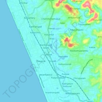
Name: Topografische Karte Kanhangad, Höhe, Relief.
Durchschnittliche Höhe: 19 m
Minimale Höhe: -2 m
Maximale Höhe: 151 m