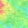
Topografische Karte County Durham
Klicken Sie auf die Karte, um die Höhe anzuzeigen.
Über diese Karte

Name: Topografische Karte County Durham, Höhe, Relief.
Ort: County Durham, England, United Kingdom (54.45113 -2.35574 54.91869 -1.14753)
Durchschnittliche Höhe: 204 m
Minimale Höhe: -3 m
Maximale Höhe: 784 m
Andere topografische Karten
Klicken Sie auf eine Karte, um ihre Topografie, ihre Höhe und ihr Relief anzuzeigen.
Cambridge
United Kingdom > England > Cambridge
The city, like most of the UK, has a maritime climate highly influenced by the Gulf Stream. Located in the driest region of Britain, Cambridge's rainfall averages around 570 mm (22.44 in) per year, around half the national average, with some years occasionally falling into the semi-arid (under 500 mm (19.69…
Durchschnittliche Höhe: 18 m
Leeds
Lying in the eastern foothills of the Pennines, there is a significant variation in elevation within the city's built-up area. The district ranges from 1,115 feet (340 m) in the far west on the slopes of Ilkley Moor to about 33 feet (10 m) where the rivers Aire and Wharfe cross the eastern boundary. Land rises…
Durchschnittliche Höhe: 94 m
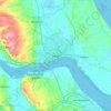
Hull
United Kingdom > England > Kingston upon Hull
Kingston upon Hull is on the northern bank of the Humber Estuary. The city centre is west of the River Hull and close to the Humber. The city is built upon alluvial and glacial deposits which overlie chalk rocks but the underlying chalk has no influence on the topography. The land within the city is generally…
Durchschnittliche Höhe: 21 m
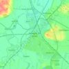
Newark on Trent
United Kingdom > England > Nottinghamshire > Newark and Sherwood
Durchschnittliche Höhe: 18 m

Hawkshead Farm
United Kingdom > England > Hertfordshire > Welwyn Hatfield > North Mymms
Durchschnittliche Höhe: 96 m
Clapham
In 1848, Clapham was described in the Topographical Dictionary of England as a village which "has for many years, been one of the most respectable in the environs of the metropolis". At this time, the patronage of Holy Trinity church belonged to the Atkins family.
Durchschnittliche Höhe: 22 m
Maidenhead
United Kingdom > England > Royal Borough of Windsor and Maidenhead
Durchschnittliche Höhe: 41 m




Swindon
United Kingdom > England > Swindon
Swindon has an oceanic climate (Cfb in the Köppen climate classification), like the vast majority of the British Isles, with cool winters and warm summers. The nearest official weather station is RAF Lyneham, about 10 miles (16 km) west southwest of Swindon town centre. The weather station's elevation is 145…
Durchschnittliche Höhe: 108 m

Staines-upon-Thames
United Kingdom > England > Surrey > Borough of Spelthorne
Much of the town is built on gravel "islands" that rise above the low-lying floodplains of the Thames and Colne. These gravel deposits have a typical maximum elevation of 14 m (46 ft) above ordnance datum (AOD) and are as little as 0.5 m (1.6 ft) above the surrounding floodplain. Staines High Street, oriented…
Durchschnittliche Höhe: 20 m

Devil's Punch Bowl
United Kingdom > England > Surrey > Waverley > Thursley
Durchschnittliche Höhe: 207 m


Minions
United Kingdom > England > Cornwall
The climate of Minions is Oceanic but, like the rest of Bodmin Moor, due to its higher altitude, it is often cooler, windier and wetter. However, there is a good balance of fair days too, which can get warm in the summer. In winter frosts are common and even though it snows most years, it is never prolonged or…
Durchschnittliche Höhe: 265 m


Lower Morton
United Kingdom > England > South Gloucestershire > Thornbury
Durchschnittliche Höhe: 30 m

Oldham
United Kingdom > England > Oldham
By 1756, Oldham had emerged as centre of the hatting industry in England. The rough felt used in the production process is the origin of the term "Owdham Roughyed" a nickname for people from Oldham. It was not until the last quarter of the 18th century that Oldham changed from being a cottage industry township…
Durchschnittliche Höhe: 173 m

Harrow
United Kingdom > England > London Borough of Harrow > Harrow
The town centre is about 220 feet (67 m) above sea level, almost 200 feet (61 m) below the top of Harrow Hill, which is an outlying knoll. The hill is half a mile south of the town centre, and the settlement is rich with historic architecture and has a village atmosphere. The steep climb towards the hill is…
Durchschnittliche Höhe: 57 m

Bournemouth
United Kingdom > England > Bournemouth, Christchurch and Poole
Durchschnittliche Höhe: 21 m


Mansfield Woodhouse
United Kingdom > England > Nottinghamshire > Mansfield
Durchschnittliche Höhe: 114 m


Malvern
United Kingdom > England > Worcestershire > Malvern Hills
Malvern lies in the Lower Severn/Avon plain affording it a degree of shelter caused by virtue of its nestling in between the Cotswold hills to the east, the Welsh Hills and Mountains to the west, and Birmingham plateau to the north. Although as with all the British Isles it has a maritime climate, the local…
Durchschnittliche Höhe: 95 m
Putney
Putney Heath is around 400 acres (160 hectares) less the nascent A3 road in size and rises to 45 metres (148 ft) above sea level. Because of its elevation, from 1796 to 1816 Putney Heath hosted a station in the shutter telegraph chain, which connected the Admiralty in London to its naval ships in Portsmouth.…
Durchschnittliche Höhe: 18 m


Kibworth Harcourt
United Kingdom > England > Leicestershire > Harborough
Durchschnittliche Höhe: 117 m

Plymouth
United Kingdom > England > Devon > Plymouth
The River Plym, which flows off Dartmoor to the north-east, forms a smaller estuary to the east of the city called Cattewater. Plymouth Sound is protected from the sea by the Plymouth Breakwater, in use since 1814. In the Sound is Drake's Island which is seen from Plymouth Hoe, a flat public area on top of…
Durchschnittliche Höhe: 81 m


Brockholes Nature Reserve
United Kingdom > England > Lancashire > Preston
Durchschnittliche Höhe: 32 m

Salford
At 53°28′59″N 2°17′35″W / 53.48306°N 2.29306°W / 53.48306; -2.29306 (53.483°, −2.2931°), and 205 miles (330 km) northwest of central London, Salford stands about 177 feet (54 m) above sea level, on relatively flat ground to the west of a meander of the River Irwell – the city's main…
Durchschnittliche Höhe: 106 m








Atherton
There were several ministers of note of Chowbent Chapel including James Wood, the "General" (1672–1759), who distinguished himself at the Battle of Preston in 1715. Thomas Walker Horsfield (1792–1837) was a historian and topographer. Joseph Nightingale (1775–1824), born in Chowbent, was a prolific…
Durchschnittliche Höhe: 69 m




Abington Park
United Kingdom > England > West Northamptonshire > Northampton
Durchschnittliche Höhe: 85 m


Bebington
Bebington is on the eastern side of the Wirral Peninsula, approximately 10 km (6.2 mi) south-south-east of the Irish Sea at New Brighton, about 7.5 km (4.7 mi) east-north-east of the Dee Estuary at Gayton and less than 2 km (1.2 mi) west-north-west of the River Mersey at New Ferry. The area is situated at an…
Durchschnittliche Höhe: 28 m