Geolokalisieren

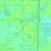
Topografische Karte Bird Key

Klicken Sie auf die Karte, um die Höhe anzuzeigen.

Über diese Karte

Name: Topografische Karte Bird Key, Höhe, Relief.

Ort: Bird Key, Sarasota, Sarasota County, Florida, United States (27.30996 -82.56494 27.32947 -82.55511)

Durchschnittliche Höhe: 1 m

Minimale Höhe: -2 m

Maximale Höhe: 18 m

Andere topografische Karten

Klicken Sie auf eine Karte, um ihre Topografie, ihre Höhe und ihr Relief anzuzeigen.
Lido Key

United States > Florida > Sarasota County > Sarasota

Durchschnittliche Höhe: 5 m

Sarasota Heights

United States > Florida > Sarasota County > Sarasota

Durchschnittliche Höhe: 7 m

Siesta Key

United States > Florida > Sarasota County > Sarasota

Durchschnittliche Höhe: 2 m

Sarasota

United States > Florida > Sarasota County > Sarasota

Durchschnittliche Höhe: 6 m

South Sarasota

United States > Florida > Sarasota County > Sarasota

Durchschnittliche Höhe: 6 m

Sarasota Heights

United States > Florida > Sarasota County > Sarasota

Durchschnittliche Höhe: 7 m

North Sarasota

United States > Florida > Sarasota County > Sarasota

Durchschnittliche Höhe: 12 m

Lido Key

United States > Florida > Sarasota County > Sarasota

Durchschnittliche Höhe: 5 m

North Sarasota

United States > Florida > Sarasota County > Sarasota

Durchschnittliche Höhe: 12 m

Fruitville

United States > Florida > Sarasota County > Sarasota

Durchschnittliche Höhe: 10 m

Southgate

United States > Florida > Sarasota County > Sarasota

Durchschnittliche Höhe: 10 m

Rüsten Sie sich für Ihr nächstes Abenteuer:

🧺Faltbare Sitzkissen - Trockene und warme Pausen auf jedem Untergrund
🏔️Barometrische Höhenmesser - Präzise Höhenbestimmung unabhängig von GPS-Signalen
🔭Leichte Reisestative - Stabile Basis für Fotos und Spektive bei geringem Gewicht
🎒Rucksack Regenhülle - Schützt Equipment bei Regen
🛋️Leichte Campingstühle - Faltbarer Komfort für die Rast nach der Wanderung

Als Amazon-Partner erhält diese Website eine Provision für qualifizierte Käufe, ohne zusätzliche Kosten für Sie.