
Topografische Karte Pushkar Lake
Interaktive Karte
Klicken Sie auf die Karte, um die Höhe anzuzeigen.
Über diese Karte
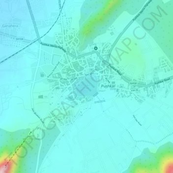
Name: Topografische Karte Pushkar Lake, Höhe, Relief.
Durchschnittliche Höhe: 496 m
Minimale Höhe: 455 m
Maximale Höhe: 727 m
Pushkar Lake around which the Pushkar town has developed is in the Ajmer district in the state of Rajasthan, India amidst the Aravalli range of hills. The mountain range known as Nag Parbat ("snake mountain") separates the lake from the city of Ajmer. The valley is formed between the two parallel ranges of the Aravalli hills (in elevation range of 650–856 metres (2,133–2,808 ft) running south-west to north-east. Situated at 14 kilometres (8.7 mi) northwest from Ajmer, the artificial Pushkar Lake created by building a dam is surrounded by deserts and hills on all three sides. The lake is categorized as a "Sacred Lake" under the list of "Classification of Lakes in India".