
Topografische Karte Mt. Yamato-Katsuragi
Interaktive Karte
Klicken Sie auf die Karte, um die Höhe anzuzeigen.
Über diese Karte
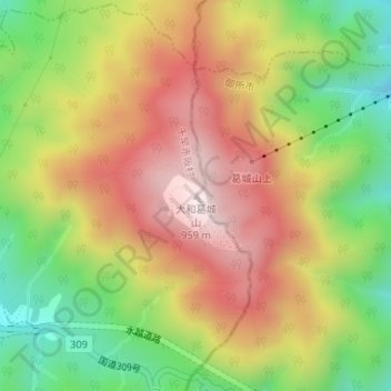
Name: Topografische Karte Mt. Yamato-Katsuragi, Höhe, Relief.
Durchschnittliche Höhe: 653 m
Minimale Höhe: 344 m
Maximale Höhe: 952 m
Mount Yamato Katsuragi (大和葛城山, Yamato Katsuragi-san) or simply Mount Katsuragi is a mountain in the Kongō Range straddling the prefectural border between Chihayaakasaka, Osaka and Gose, Nara in Japan. The peak elevation is 959.2 metres (3,147 ft). The mountain is located along the Gose Line of the Kintetsu Railway.