
Topografische Karte Iturup
Interaktive Karte
Klicken Sie auf die Karte, um die Höhe anzuzeigen.
Iturup
The deposits of the Vetrovoy Isthmus include volcanic-tectonic dislocations, pumice pyroclastics, aeolian-ash deposits and soil-tephra formations. The morphometric parameters of the basement terrace indicate an area elevation rate during the last phase of coastal marine accumulation that could reach 4 mm/year, slightly higher than the 3.5 m/year recorded during the last 6000 thousand years.
Über diese Karte
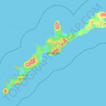
Name: Topografische Karte Iturup, Höhe, Relief.
Durchschnittliche Höhe: 31 m
Minimale Höhe: 0 m
Maximale Höhe: 1.605 m