
Topografische Karte Leavenworth
Interaktive Karte
Klicken Sie auf die Karte, um die Höhe anzuzeigen.
Über diese Karte
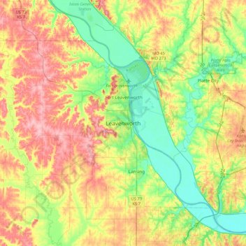
Name: Topografische Karte Leavenworth, Höhe, Relief.
Durchschnittliche Höhe: 277 m
Minimale Höhe: 223 m
Maximale Höhe: 347 m
Leavenworth is located at 39°18′40″N 94°55′21″W / 39.31111°N 94.92250°W / 39.31111; -94.92250 (39.3111112, −94.9224637) at an elevation of 840 feet (256 m).[5] Located in northeastern Kansas at the junction of U.S. Route 73 and Kansas Highway 92 (K-92), Leavenworth is 25 mi (40 km) northwest of downtown Kansas City, 145 mi (233 km) south-southeast of Omaha, and 165 mi (266 km) northeast of Wichita.[18][19]