
Topografische Karte Jomsom
Interaktive Karte
Klicken Sie auf die Karte, um die Höhe anzuzeigen.
Über diese Karte
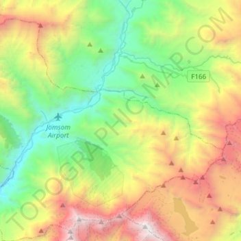
Name: Topografische Karte Jomsom, Höhe, Relief.
Ort: Jomsom, Gharapjhong, मुस्ताङ, Provinz Gandaki, Nepal (28.68667 83.64637 28.86745 83.89084)
Durchschnittliche Höhe: 4.121 m
Minimale Höhe: 2.531 m
Maximale Höhe: 7.112 m
Jomsom (auch Jomosom) (Nepali .mw-parser-output .Deva{font-size:120%}@media all and (min-width:800px){.mw-parser-output .Deva{font-size:calc(120% - ((100vw - 800px)/80))}}@media all and (min-width:1000px){.mw-parser-output .Deva{font-size:100%}}जोमसोम) ist ein Dorf und ein Village Development Committee im oberen Kali-Gandaki-Tal in Nepal und liegt auf einer Höhe von 2770 m.
Andere topografische Karten
Klicken Sie auf eine Karte, um ihre Topografie, ihre Höhe und ihr Relief anzuzeigen.
Lamanthang
Nepal > मुस्ताङ > Lomanthang
Lamanthang, Lomanthang, मुस्ताङ, Provinz Gandaki, Nepal
Durchschnittliche Höhe: 4.899 m
Sekung Lake
Nepal > मुस्ताङ > Kowang > Naurikot
Sekung Lake, Dhaulagiri Ice Fall route, Naurikot, Kowang, Thasang, मुस्ताङ, Provinz Gandaki, Nepal
Durchschnittliche Höhe: 2.882 m