
Topografische Karte Bridgewater
Interaktive Karte
Klicken Sie auf die Karte, um die Höhe anzuzeigen.
Bridgewater
According to the United States Census Bureau, the town has a total area of 2.52 sq mi (6.5 km2), nearly all of it being land. Most of the town is located within a bend of the North River. Floods have wrecked the town occasionally. The northern areas are partly shielded from flooding with an Army Corps of Engineers dam. The wooded monadnock called Round Hill (elevation approx. 1750 feet) dominates the town's western skyline.
Über diese Karte
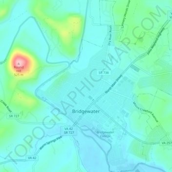
Name: Topografische Karte Bridgewater, Höhe, Relief.
Ort: Bridgewater, Rockingham County, Virginia, United States (38.36928 -78.98997 38.40543 -78.94621)
Durchschnittliche Höhe: 380 m
Minimale Höhe: 351 m
Maximale Höhe: 515 m
Andere topografische Karten
Klicken Sie auf eine Karte, um ihre Topografie, ihre Höhe und ihr Relief anzuzeigen.