Geolokalisieren

Topografische Karte Koshlong Lake

Klicken Sie auf die Karte, um die Höhe anzuzeigen.

Über diese Karte

Name: Topografische Karte Koshlong Lake, Höhe, Relief.

Ort: Koshlong Lake, Highlands East, Haliburton County, Central Ontario, Ontario, Canada (44.95057 -78.52402 44.98183 -78.45250)

Durchschnittliche Höhe: 366 m

Minimale Höhe: 331 m

Maximale Höhe: 406 m

Andere topografische Karten

Klicken Sie auf eine Karte, um ihre Topografie, ihre Höhe und ihr Relief anzuzeigen.
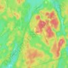
Gooderham

Canada > Ontario > Haliburton County > Highlands East

Durchschnittliche Höhe: 349 m

Cope Lake

Canada > Ontario > Haliburton County > Highlands East

Durchschnittliche Höhe: 453 m

Highland Grove

Canada > Ontario > Haliburton County > Highlands East

Durchschnittliche Höhe: 435 m

Tory Creek

Canada > Ontario > Haliburton County > Highlands East

Durchschnittliche Höhe: 393 m

Wilberforce

Canada > Ontario > Haliburton County > Highlands East

Durchschnittliche Höhe: 407 m

Colbourne Creek

Canada > Ontario > Haliburton County > Highlands East

Durchschnittliche Höhe: 413 m

Cardiff

Canada > Ontario > Haliburton County > Highlands East

Durchschnittliche Höhe: 366 m

Little Maple Lake

Canada > Ontario > Haliburton County > Highlands East

Durchschnittliche Höhe: 452 m

Koshlong Lake

Canada > Ontario > Haliburton County > Highlands East

Durchschnittliche Höhe: 357 m

Tory Hill

Canada > Ontario > Haliburton County > Highlands East

Durchschnittliche Höhe: 401 m

Rüsten Sie sich für Ihr nächstes Abenteuer:

🧢Outdoor-Hüte - Sonnenschutz für Kopf und Nacken im Hochgebirge
🔭Wasserdichte Ferngläser - Ideal für die Orientierung an Seen und Küsten
📍GPS Wanderuhr - Smartwatch mit Navigation & Kartenfeatures
🔥Camping Grill Set - Grillset für Outdoor Küche
🧦Thermo Wandersocken - Komfortable Socken für lange Touren

Als Amazon-Partner erhält diese Website eine Provision für qualifizierte Käufe, ohne zusätzliche Kosten für Sie.