
Topografische Karte Santo Domingo
Interaktive Karte
Klicken Sie auf die Karte, um die Höhe anzuzeigen.
Über diese Karte
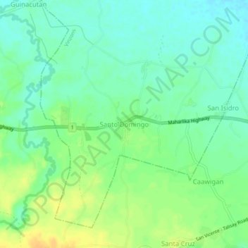
Name: Topografische Karte Santo Domingo, Höhe, Relief.
Durchschnittliche Höhe: 15 m
Minimale Höhe: 3 m
Maximale Höhe: 31 m
Andere topografische Karten
Klicken Sie auf eine Karte, um ihre Topografie, ihre Höhe und ihr Relief anzuzeigen.
Aguit-it
Philippines > Camarines Norte > Vinzons
Aguit-it, Vinzons, Camarines Norte, Bicol Region, 4603, Philippines
Durchschnittliche Höhe: 5 m
Calaguas Group of Islands
Philippines > Camarines Norte > Vinzons
Calaguas Group of Islands, Vinzons, Camarines Norte, Bicol Region, 4603, Philippines
Durchschnittliche Höhe: 1 m