
Topografische Karte Les Bercelleries
Interaktive Karte
Klicken Sie auf die Karte, um die Höhe anzuzeigen.
Über diese Karte
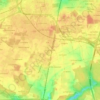
Name: Topografische Karte Les Bercelleries, Höhe, Relief.
Durchschnittliche Höhe: 90 m
Minimale Höhe: 60 m
Maximale Höhe: 101 m
Andere topografische Karten
Klicken Sie auf eine Karte, um ihre Topografie, ihre Höhe und ihr Relief anzuzeigen.
Le Clos Neuf
France > Centre-Val de Loire > Indre-et-Loire > Joué-lès-Tours
Le Clos Neuf, Joué-lès-Tours, Tours, Indre-et-Loire, Centre-Val de Loire, France métropolitaine, 37300, France
Durchschnittliche Höhe: 74 m
La Gare
France > Centre-Val de Loire > Indre-et-Loire > Joué-lès-Tours
La Gare, Joué-lès-Tours, Arrondissement de Tours, Indre-et-Loire, Centre-Val de Loire, France métropolitaine, 37300, France
Durchschnittliche Höhe: 76 m
Manoir de Chérizy
France > Centre-Val de Loire > Indre-et-Loire > Joué-lès-Tours
Manoir de Chérizy, Rue de Chérisy, Le Val Violet, Joué-lès-Tours, Tours, Indre-et-Loire, Centre-Val de Loire, France métropolitaine, 37300, France
Durchschnittliche Höhe: 73 m