
Topografische Karte Gallarate
Interaktive Karte
Klicken Sie auf die Karte, um die Höhe anzuzeigen.
Gallarate
Founded by the Gauls and later conquered by the Romans, Gallarate was mentioned as an important vicus or village in documents dating back to the Roman conquest of what was then called Gallia Cisalpina. After the Carolingian conquest of northern-central Italy, a castle was erected upon the remains of the original Roman fortifications located beside the still-existing Basilica of Santa Maria. The castle has disappeared, but its ancient location is identified through the city's topography and by the street name Via Postcastello.
Über diese Karte
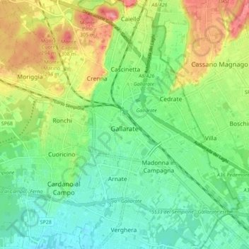
Name: Topografische Karte Gallarate, Höhe, Relief.
Ort: Gallarate, Varese, Lombardy, 21013, Italy (45.63119 8.75368 45.69043 8.83244)
Durchschnittliche Höhe: 254 m
Minimale Höhe: 222 m
Maximale Höhe: 309 m
Andere topografische Karten
Klicken Sie auf eine Karte, um ihre Topografie, ihre Höhe und ihr Relief anzuzeigen.