
Topografische Karte Horse Shoe Run
Interaktive Karte
Klicken Sie auf die Karte, um die Höhe anzuzeigen.
Über diese Karte
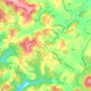
Name: Topografische Karte Horse Shoe Run, Höhe, Relief.
Durchschnittliche Höhe: 787 m
Minimale Höhe: 692 m
Maximale Höhe: 888 m
Andere topografische Karten
Klicken Sie auf eine Karte, um ihre Topografie, ihre Höhe und ihr Relief anzuzeigen.
Rowlesburg
United States > West Virginia > Preston County
Rowlesburg, Preston County, West Virginia, United States
Durchschnittliche Höhe: 564 m
Caddell
United States > West Virginia > Preston County
Caddell, Preston County, West Virginia, 26537, United States
Durchschnittliche Höhe: 487 m
Kingwood
United States > West Virginia > Preston County
Kingwood, Preston County, West Virginia, 26537, United States
Durchschnittliche Höhe: 530 m
Terra Alta
United States > West Virginia > Preston County
Terra Alta, Preston County, West Virginia, United States
Durchschnittliche Höhe: 775 m
Mount Nebo
United States > West Virginia > Preston County
Mount Nebo, Preston County, West Virginia, United States
Durchschnittliche Höhe: 552 m
Aurora
United States > West Virginia > Preston County
Aurora, Preston County, West Virginia, 26705, United States
Durchschnittliche Höhe: 812 m
Preston
United States > West Virginia > Preston County
Preston, Preston County, West Virginia, 26537, United States
Durchschnittliche Höhe: 502 m
Alpine Lake
United States > West Virginia > Preston County > Alpine Lake
Alpine Lake, Preston County, West Virginia, 26764, United States
Durchschnittliche Höhe: 830 m
Eglon
United States > West Virginia > Preston County
Eglon, Preston County, West Virginia, 26716, United States
Durchschnittliche Höhe: 816 m
Newburg
United States > West Virginia > Preston County
Newburg, Preston County, West Virginia, 26410, United States
Durchschnittliche Höhe: 451 m
Bruceton Mills
United States > West Virginia > Preston County
Bruceton Mills, Preston County, West Virginia, United States
Durchschnittliche Höhe: 508 m