
Topografische Karte Brusnica
Interaktive Karte
Klicken Sie auf die Karte, um die Höhe anzuzeigen.
Über diese Karte
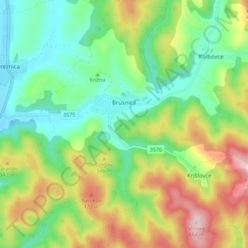
Name: Topografische Karte Brusnica, Höhe, Relief.
Durchschnittliche Höhe: 286 m
Minimale Höhe: 172 m
Maximale Höhe: 483 m
The municipality lies at an altitude of 199 metres and covers an area of 14.283 km². It has a population of about 415 people. The village has a significant Rusyn minority (32%) and smaller Romani minority (2%), along with the majority of Slovaks (65%).