
Topografische Karte St. Joseph Island
Interaktive Karte
Klicken Sie auf die Karte, um die Höhe anzuzeigen.
Über diese Karte
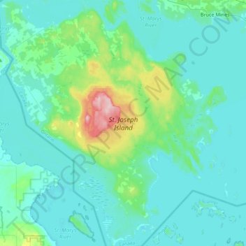
Name: Topografische Karte St. Joseph Island, Höhe, Relief.
Durchschnittliche Höhe: 196 m
Minimale Höhe: 171 m
Maximale Höhe: 348 m
Its highest point, known colloquially and by surveyors as "the Mountain," is near the centre of the island near Carterton with an elevation of 345.6 m, which is about 169 m above Lake Huron.